Services
We handle the GIS so you can focus on the land. Purpose-built tools for Friends groups, conservancies, and public lands organizations.
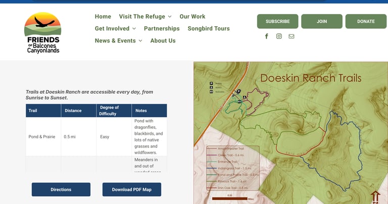
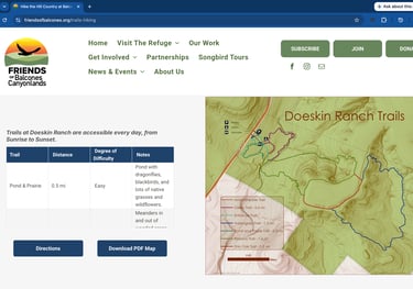
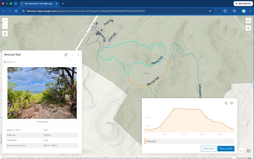
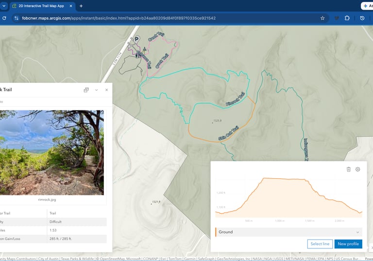
TRAIL & VISITOR MAPS
Help People Find, Explore, and Love Your Land.
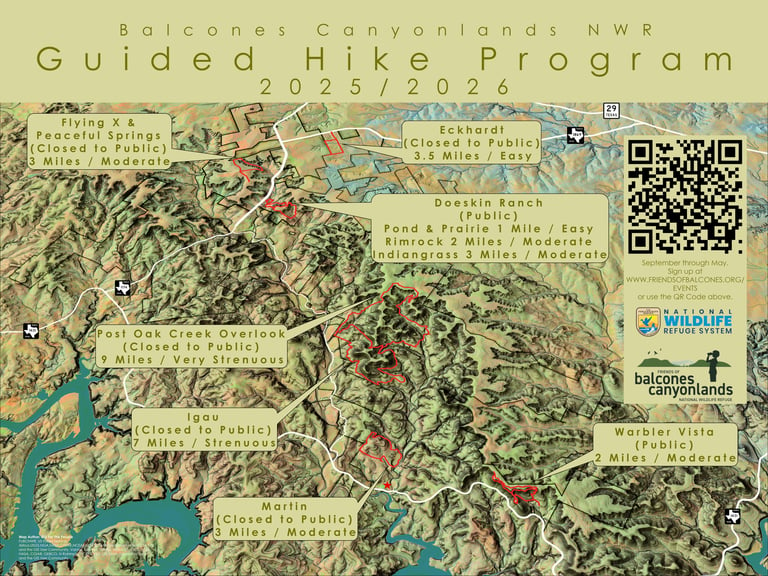
Whether you're welcoming first-time visitors or seasoned hikers, a clear map is often someone's first real connection to your organization. We design custom static and interactive trail maps tailored to your refuge, park, or preserve — built to handle the realities of mapping public land: multiple trailheads, varying difficulty, seasonal closures, and the points of interest you want visitors to find.
What this can include:
Interactive web maps with zoomable trail details, photos, and difficulty ratings
Downloadable, geo-coded GeoPDF maps for offline navigation (compatible with free apps like Avenza)
Printable trail maps and trailhead signage
Boundary and property maps for planning and outreach
VISITOR ENGAGEMENT
Bring Your Land to Life Beyond the Trailhead.
Not every supporter can make it to your trailhead — and that's an opportunity, not a limitation. We build tools that let people experience your land from anywhere: virtual hikes built from 360-degree panoramic photography, interactive storytelling experiences, and digital content designed to entice future visitors, welcome those who can't access rugged terrain in person, and connect donors to the places their support protects.
What this can include:
360-degree virtual hikes and panoramic photo experiences
Interactive story maps for interpretation and education
QR-code-linked content for trailhead signage and AllTrails integration
Accessible digital alternatives to in-person visits
STEWARDSHIP & FIELD TOOLS
Equip Your Volunteers and Staff for the Work Ahead.
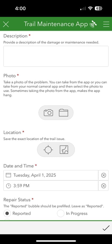
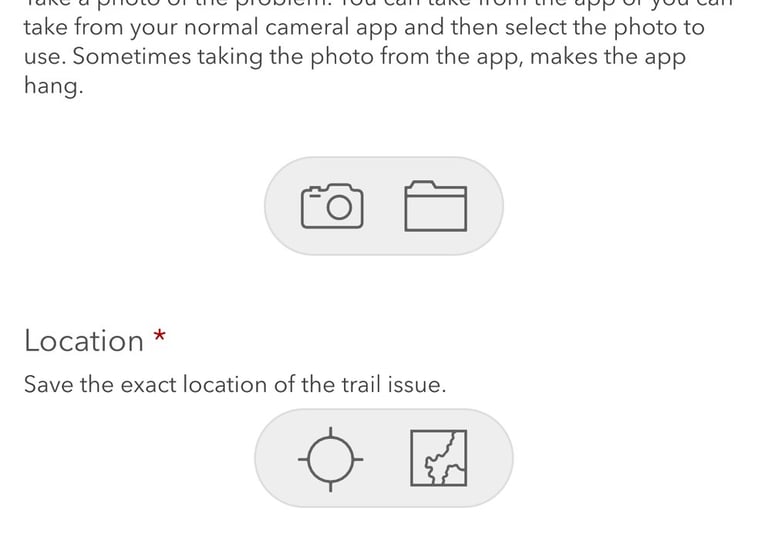
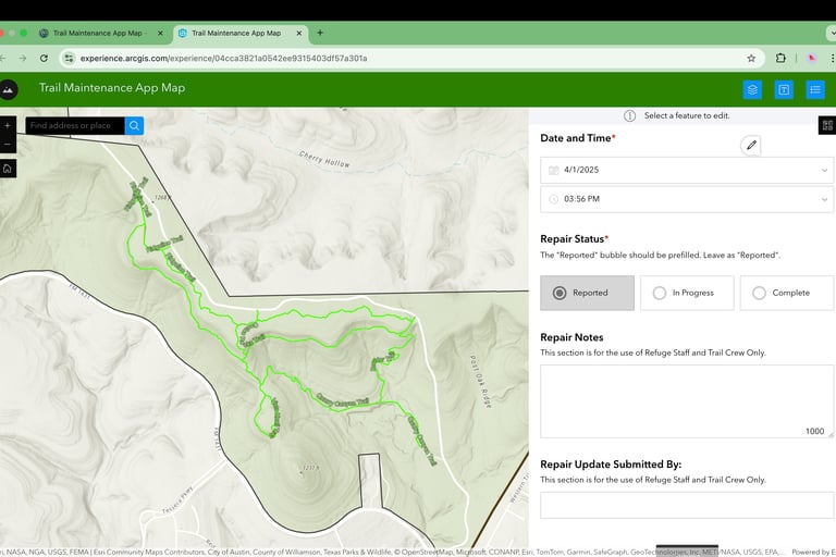
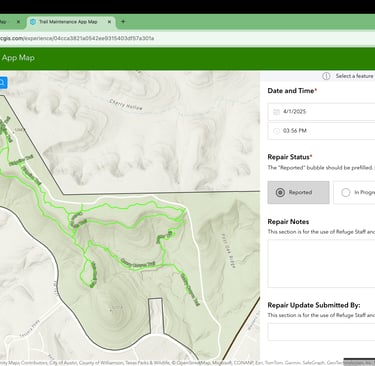
Your staff and volunteers are out on the land every week — give them tools that make that work easier, not harder. We build custom mobile apps for data collection and field reporting, so trail conditions, maintenance issues, restoration progress, and wildlife observations can be logged on-site and tracked over time, with no spreadsheets or guesswork required.
What this can include:
Mobile apps for logging trail conditions and maintenance issues, with photos and automatic location tagging
Volunteer activity tracking and reporting tools
Map-based dashboards to monitor and prioritize repairs
Wildlife and habitat observation data collection (iOS and Android compatible)
ADVOCACY & OUTREACH
Turn Your Conservation Story into Something People Won't Forget.
The right map can do more than inform — it can move people to act. We create geospatial visuals designed to support your advocacy, fundraising, and outreach efforts: maps that make a land protection case to legislators, visuals that anchor a newsletter or annual report, and graphics that work as well in a donor's hands as they do in a press story.
What this can include:
Advocacy maps for legislative and policy campaigns
Visuals for newsletters, annual reports, and donor communications
Land acquisition and boundary-change maps for press and public use
Custom infographics and data visualizations for fundraising appeals
Ready to Map Your Mission?
Let's talk about the maps, tools, and stewardship apps that will help your organization reach further.